Key Points Summary:Tibet consists of seven major administrative regions: Lhasa, Shigatse, Shannan, Nyingchi, Qamdo, Nagqu, and Ali. The overall topography forms a stepped pattern, with the southeast being lower and the northwest higher—Nyingchi is the lowest at approximately 2,900 meters, Lhasa, Shannan, and Qamdo are around 3,200–3,650 meters; Shigatse is about 3,840 meters; Nagqu is over 4,000 meters; and Ali, at approximately 4,500 meters, is the highest. Elevation is not a fixed value upon entering Tibet; rather, it rises gradually along the route. Additionally, the abundance of vegetation varies depending on the specific location on the plateau. This is something you should understand before planning a trip to Tibet—even before looking at a list of attractions.
Studying topographic maps of Tibet isn’t like a geography class, where you simply memorize dry text from a textbook; rather, it’s one of the key preparations for a trip to the plateau—for example, figuring out how to plan your trip to Tibet to minimize the risk of altitude sickness. Or, given how vast Tibet is, where are the airports? How should you plan your route? Since Tibet’s topography, geographical location, and elevation are closely intertwined, understanding the terrain and elevation helps you better plan your itinerary, anticipate potential physical discomfort, and even determine which attractions are simply inaccessible. For those of you who aren’t familiar with reading maps, rather than staring at a map covered with the names of mountains and rivers, follow this article to understand Tibet in the simplest way possible.
The logic behind the division of terrain into zones, and what each zone means for tourism planning.

The topography of Tibet can be divided into seven regions
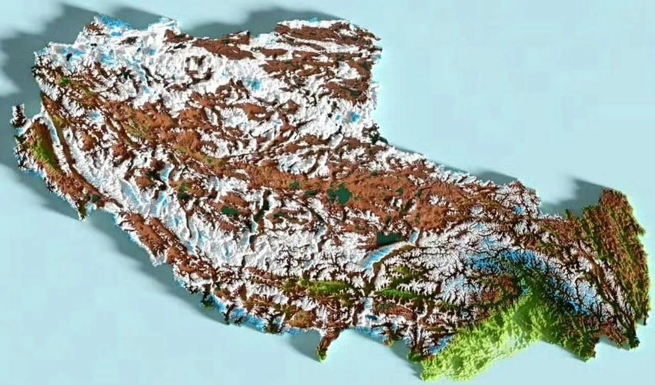
The Tibet Autonomous Region covers an area of approximately 1.2 million square kilometers and is administratively divided into seven prefecture-level administrative divisions: Lhasa, Shigatse, Shannan, Nyingchi, Qamdo, Nagqu, and the Ali Prefecture. These seven regions are not distributed randomly; the overall topography exhibits a stepped pattern characterized by “lower elevations in the southeast and higher elevations in the northwest”:
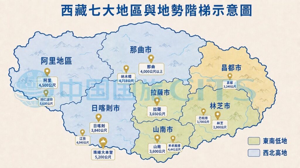
The Tibet Autonomous Region covers an area of approximately 1.2 million square kilometers and features extremely varied terrain; however, for the purposes of tourism planning, the truly meaningful classifications are roughly as follows:
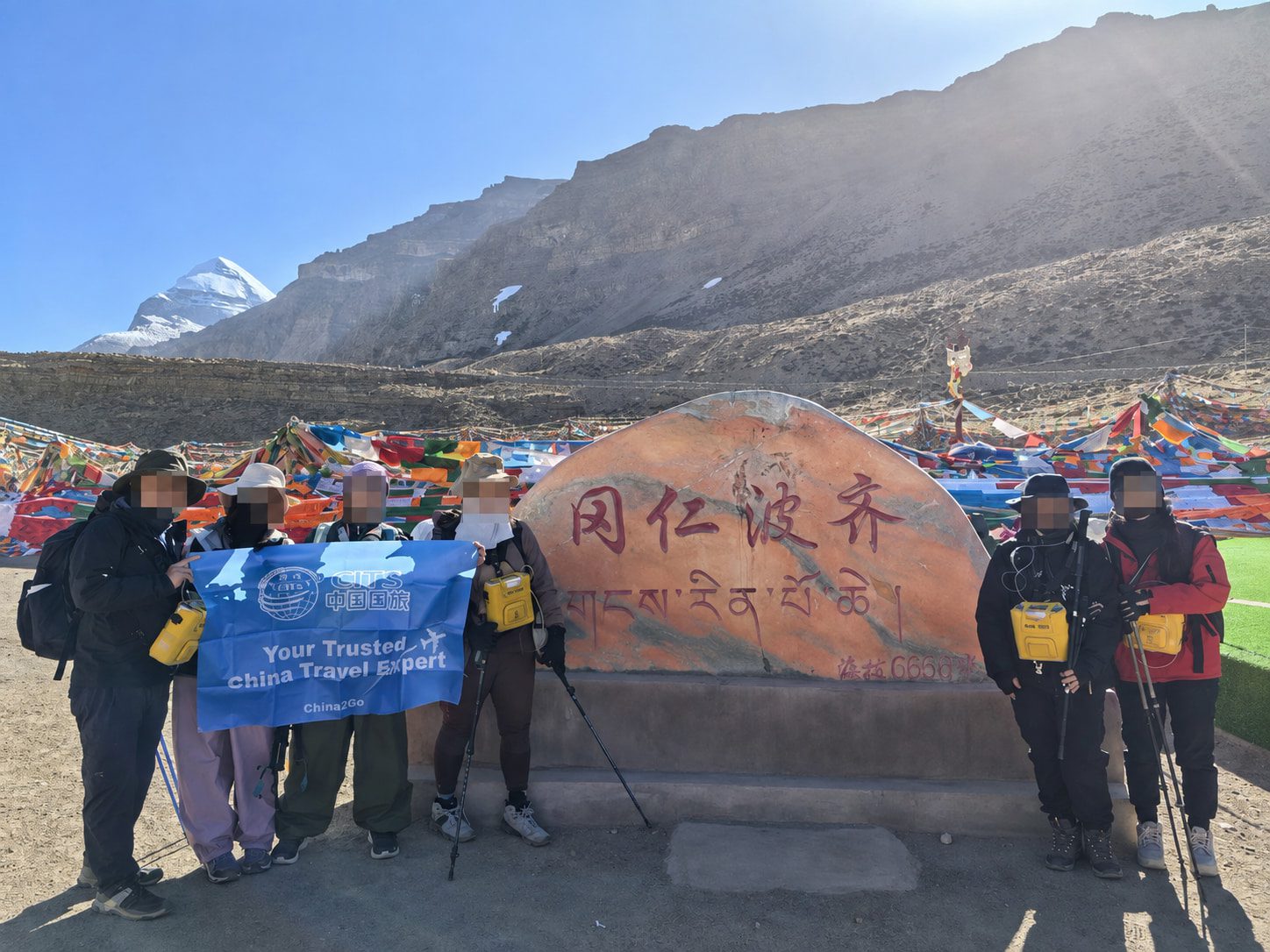
- ➤ Northern Tibetan Plateau (Nagqu and Ali regions):Elevations generally exceed 4,500 meters, and the terrain is open and flat, characteristic of a typical plateau permafrost landscape. Most standard itineraries do not venture deep into this region, unless they are specialized, in-depth routes designed for the Ali or Mount Kailash circumambulation treks.
- ➤ Southern Tibet Valley Region (Lhasa, Shigatse, Shannan):At an elevation of approximately 3,600–3,900 meters, this is the most densely populated and heavily traveled region; most of Tibet’s core tourist routes are located here, and it is also a relatively “entry-level” high-altitude environment.
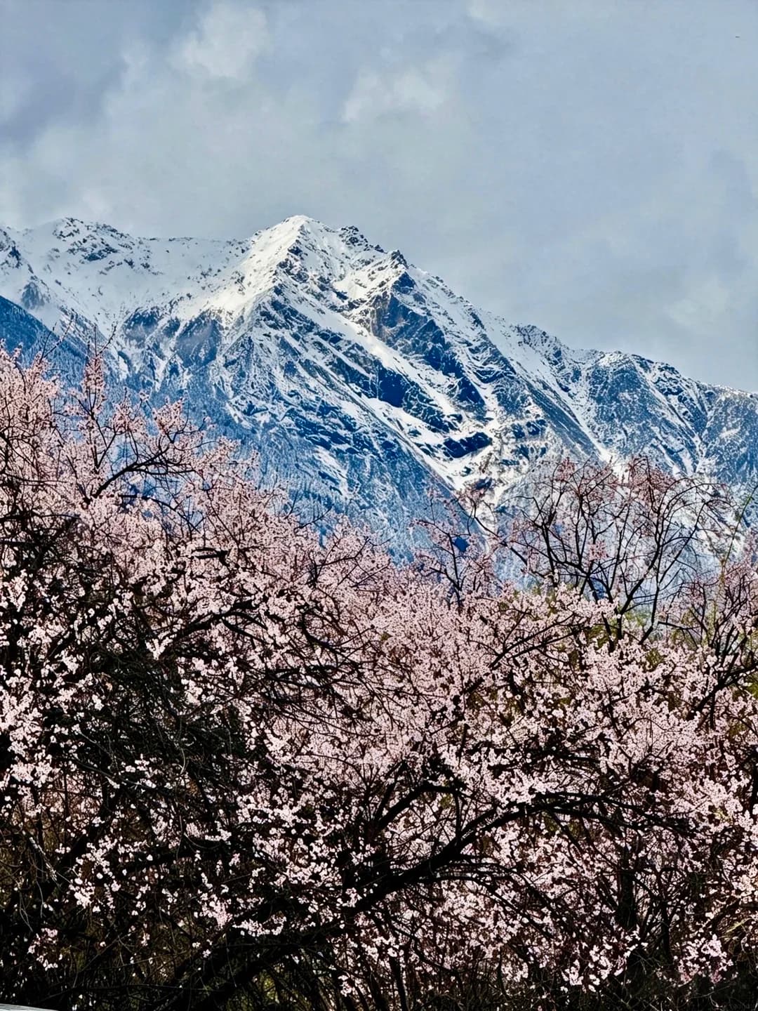
- ➤ The canyons of southeastern Tibet and the southern foothills of the Himalayas (in the Nyingchi area):The elevation changes dramatically; within just a few dozen kilometers, the terrain rises from peach orchards in a river valley at 2,900 meters all the way up to the glaciers of the Snow Mountains. The climate and vegetation change with the altitude, making this one of the few areas in Tibet where you can “see greenery.”
- ➤ Mount Everest and the Himalayan Mountain Range:At an elevation of over 5,000 meters, this is the most extreme section of the trip; it’s typically scheduled for only one or two days, and the duration depends heavily on how well your body has acclimated beforehand.
Although Lhasa is the starting point for most itineraries, it is actually a “relatively low-altitude” area within Tibet’s terrain. The real challenges often arise during the journey toward Shigatse, Mount Everest, or Ali—the altitude gradually increases along the way; it doesn’t happen all at once just because you’ve entered Tibet.
Does the Qinghai-Tibet Railway really help prevent altitude sickness?
Many people choose to take the Qinghai-Tibet Railway to Tibet based on the belief that “a gradual ascent reduces the risk of altitude sickness.” But if you actually look at the elevation figures along the route, this claim isn’t as accurate as you might think—while it’s true that the train provides oxygen throughout the journey, which can alleviate discomfort, the rate of elevation gain isn’t actually much “slower” than you might imagine.
Looking along the route from Lhasa to Xining, the altitudes of the major stations along the way are roughly as follows:
- ➤ Lhasa Station: Approximately 3,650 meters
- ➤ Naqu Station: Approximately 4,513 meters
- ➤ Tangula Station: At approximately 5,068 meters, it is the highest railway station in the world and the highest point of this journey.
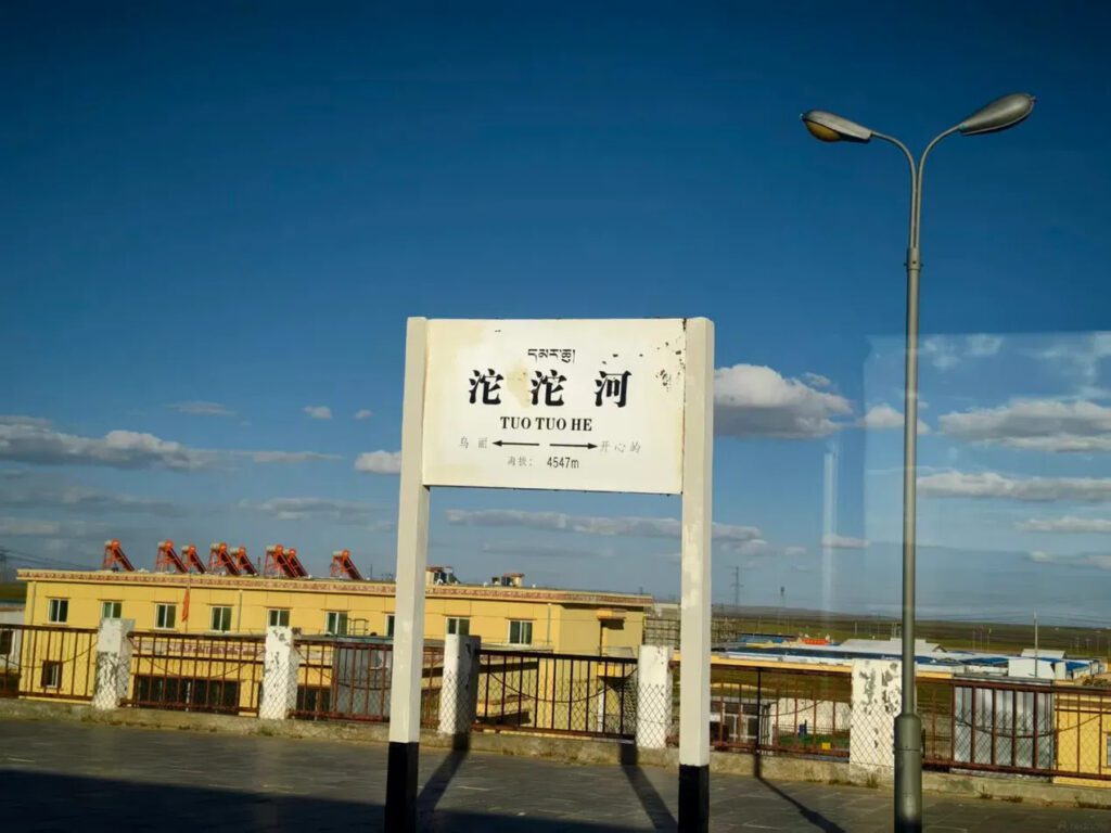
- ➤ Tuotuo River Station: Approximately 4,547 meters
- ➤ Golmud Station: Approximately 2,800 meters
- ➤ Xining Station: Approximately 2,261 meters
From Lhasa to Xining, the route first climbs more than 1,400 meters to cross the Tangula Pass, then descends all the way back to just over 2,000 meters—the entire journey takes only about 20 hours. The reverse route from Xining to Lhasa is the same: it’s equivalent to experiencing the full elevation range—rising from 2,261 meters to 5,068 meters and then descending to 3,650 meters—all within a single day. This pace isn’t really “gradual acclimatization”; rather, it’s the combination of the body experiencing both ascent and descent while in motion, coupled with the oxygen supplied in the train cars throughout the journey, that makes the experience feel more comfortable.
A more accurate way to put it is: Traveling to Tibet by train can reduce the “perceived” discomfort, since the train cars are oxygenated and you don’t have to exert yourself by walking, but that doesn’t mean your body has fully acclimated to the altitude— —Altitude sickness is primarily a physiological response to low-oxygen environments and is related to the speed of travel, but it cannot be completely avoided simply by taking the train. Whether you travel by plane or train, it’s still recommended to take it easy and avoid strenuous activity for the first day or two after arriving in Lhasa.
Another often-overlooked reality is that the lifestyle habits of travelers from Hong Kong, Macau, and Taiwan, as well as international travelers, differ from those of mainland travelers who are accustomed to taking long-distance train trips. I’m sure many people have never taken a train ride lasting more than 8 hours, let alone slept in a sleeper car—cramped berths, shared compartments, and a journey lasting around 20 hours are, in themselves, a drain on stamina and sleep quality for travelers accustomed to flying. Before blindly applying the claim that “traveling by train reduces the risk of altitude sickness” to yourself, you should think carefully: whether you can adapt to this mode of long-distance sleeper travel is actually just as important as whether you can adapt to high altitudes.
That’s why it’s usually recommended to take the Qinghai-Tibet Railway when traveling to Tibet! That way, you can truly enjoy the trip and the scenery.
What about the elevation along the G318 highway to Tibet?
Aside from airplanes and trains, the G318 Sichuan-Tibet Highway (commonly known as the “Sichuan-Tibet Route”) is another way to reach Tibet—and a rather unique one at that—though it is the most well-established route. In particular, it has served as a major thoroughfare into Tibet since the days of the Ancient Tea-Horse Trail, Today, the gas stations, lodging, repair shops, and dining options along this route are far more well-developed than on other routes into Tibet. Looking at the standard route from Chengdu to Nyingchi, the elevation along the way is roughly as follows:
- ➤ Chengdu: About 500 meters; the starting point for most itineraries, used to allow the body to make its final preparations on flat ground
- ➤ Kangding: Approximately 2,560 meters—the first town where you can really feel the altitude
- ➤ Zheduo Pass: Approximately 4,298 meters, commonly known as the “First Pass of Kangba,” it is the first 4,000-meter-class pass on this route
- ➤ Litang: Approximately 4,014 meters, known as the “Highest City in the World”; for most people, this is their first time spending the night at this altitude
- ➤ Mangkang: Approximately 3,850 meters—this is the gateway to Tibet! It is the first county seat in the Tibet Autonomous Region after crossing the Jinsha River Bridge, and serves as the gateway to Tibet on the southern route of the Sichuan-Tibet Highway.
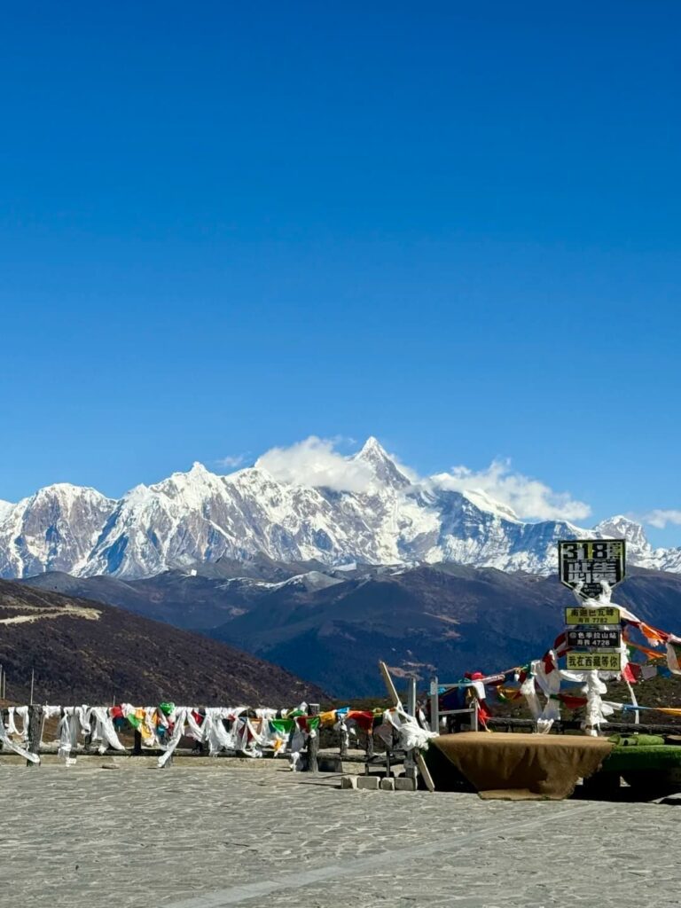
- ➤ Dongda Pass: Approximately 5,008 meters, the highest point on the southern route of the Sichuan-Tibet Highway
- ➤ Bomi: Approximately 2,725 meters; the elevation drops significantly here, so it’s common to spend a night resting here
- ➤ Nyingchi: Approximately 2,900 meters; the end of the route and one of the lowest-elevation areas in Tibet
As can be seen from the elevation figures above, the elevation profile of this route is “up and down” rather than a steady climb—after crossing the Zheduo Pass, Dongda Mountain—one typically doesn’t linger long after crossing these passes, which are over 4,000 meters high; instead, one quickly descends to spend the night in towns at lower elevations. Since the driving pace isn’t as fast as that of the Qinghai-Tibet Railway, this is why the Sichuan-Tibet route offers the body more time to acclimate compared to other routes into Tibet.
However, if you choose this route, there are a few things you should know first:
- ➤ The pace of the trip is a mix of walking and stopping:The mountain roads along the way are full of sharp turns and steep inclines, and since some sections are still unpaved gravel paths, it’s hard to drive fast. As a result, the actual distance covered in a day often takes longer than the straight-line distance shown on the map would suggest.
- ➤ Travelers with a letter of entry into Tibet are currently not permitted to drive themselves:Foreign nationals and travelers from Hong Kong, Macao, and Taiwan must obtain the necessary travel permits to enter Tibet. Under current regulations, these travelers are not permitted to drive themselves; they must be driven by a locally licensed driver and accompanied by a tour guide!
- ➤ This really puts the driver's experience to the test:Crossing multiple high-altitude passes in succession, navigating winding mountain roads, and dealing with passengers who may experience altitude sickness all put a strain on drivers’ experience and stamina—which is why drivers on the Sichuan-Tibet route typically need many years of experience driving this route.
- ➤ Snowy road conditions can be hazardous:In winter, some mountain passes are prone to road closures due to snowfall or icy road conditions; it is generally recommended that the period from May through September is the most stable time to travel, while the risk increases significantly during the remaining months.
Overall, the G318 is the route that allows travelers to experience changes in elevation in the most “gradual” way among the three routes into Tibet,However, it is also the option that requires the most time and places the highest demands on physical stamina and patience.—No single way to travel to Tibet is perfect; it ultimately depends on which option best suits the traveler’s schedule, physical condition, and desired pace of travel.
The difference in elevation determines how long it takes the body to adjust.
The key to altitude sickness isn’t “how high the elevation is,” but “how quickly you ascend.” Flying directly from sea level to Lhasa instantly raises your elevation to 3,650 meters; this is when most people experience the most pronounced symptoms of altitude sickness during the first day or two. Common symptoms include headaches, mild insomnia, and slight shortness of breath when walking. However, if the itinerary continues on to Shigatse or even Everest Base Camp, the body must adapt to several altitude changes in quick succession within a short period of time. As a result, the symptoms may accumulate rather than being resolved once and for all after the first day of acclimatization.
On a topographic map, it may look like just a route, but when you actually set out on it, it’s a process where your body must constantly readjust to changes in air pressure and oxygen levels. How the itinerary is paced—whether to rest on the first day and ascend gradually, or to push directly to high altitudes—directly affects the comfort of the entire trip and serves as a key indicator of a Tibet itinerary’s quality, often proving more crucial than the number of attractions visited.
If you're really concerned about the difference in altitude on the first day, there's actually another option: fly to Nyingchi Airport first....rather than flying directly to Lhasa. Nyingchi is at an elevation of only about 2,900 meters—more than 700 meters lower than Lhasa—which gives your body some extra time to acclimate. By traveling from Nyingchi all the way to Lhasa, or even to areas at higher elevations, the adjustment to the altitude difference will be much smoother.
In addition to how to “climb,” knowing how to “rest” is just as important—if not more so. China National Travel Service offers small group tours of 4–6 people,Oxygen is primarily supplied via a diffusive system on the bus, and all accommodations along the route are oxygen-supplying hotels....plus, the tour guide adjusts the pace at any time based on how each person is doing—it’s not just about getting through the itinerary, but about someone actually paying attention to who’s getting short of breath or who doesn’t look quite right.
The quality of rest and the level of care you receive often determine whether your body can keep up—more so than "how many meters you climbed today."
One more thing to keep in mind: It’s common to see so-called “doctors” getting into vehicles or visiting hotels to provide health checkups for travelers. These checkups are often unprofessional, and their diagnoses may even be incorrect, leading travelers to misjudge their condition and make inappropriate decisions. Our in-depth article below provides a comprehensive explanation of how to properly assess altitude sickness and what health coverage you should actually have.
★Helpful Reminder: Weather in Tibet’s high-altitude regions changes much more rapidly than at lower elevations; within a single day, you may experience everything from bright sunshine to sudden showers or even light snowfall. Road conditions in mountainous areas may also be subject to last-minute adjustments due to seasonal changes and snowfall. We recommend packing layers of clothing and allowing for some flexibility in your itinerary—don’t schedule every day too tightly. Choosing a tour operator like China2Go, which specializes in hosting international travelers as well as visitors from Hong Kong, Macau, and Taiwan, will ensure your itinerary and accommodations are better suited to your needs.
You have to understand the map of Tibet to understand why the itinerary is arranged this way.
Terrain is not just background information; it is actually the core logic behind itinerary design. China National Travel Service’s Tibet itineraries are structured with consideration for the pace of altitude gain, allowing the body time to acclimate, rather than simply stringing together attractions based on their distance on a map. All accommodations along the route are equipped with oxygen-supply facilities, minimizing the impact of altitude-related discomfort during sleep that could otherwise affect the next day’s itinerary.
Mountainous terrain is complex, and weather and road conditions are inherently more unpredictable than on flat terrain. This is why professional drivers and licensed tour guides rely on their own in-house teams rather than outsourcing or subcontracting—when unexpected road conditions or last-minute changes to the itinerary arise, they can respond directly without having to navigate layers of communication through subcontractors. For tours traversing high-altitude terrain, this flexibility is often more important than adding one more attraction to the itinerary—which is why small groups (4–6 people) tend to have a more relaxed experience in such environments: vehicle scheduling and rest stop arrangements do not need to accommodate the scheduling constraints of large tour buses.
Sources:Wikipedia—National Highway 318